
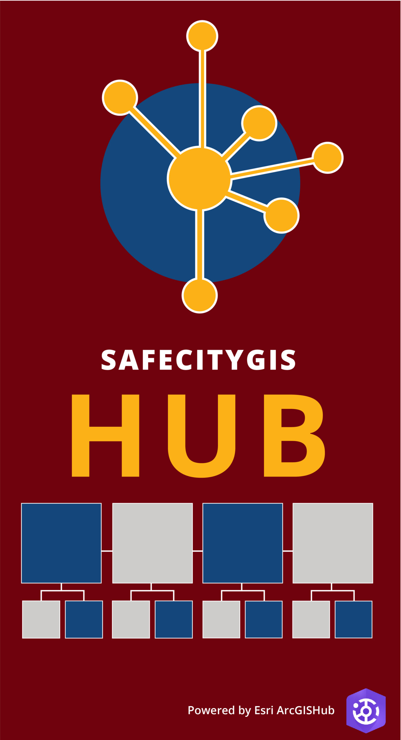
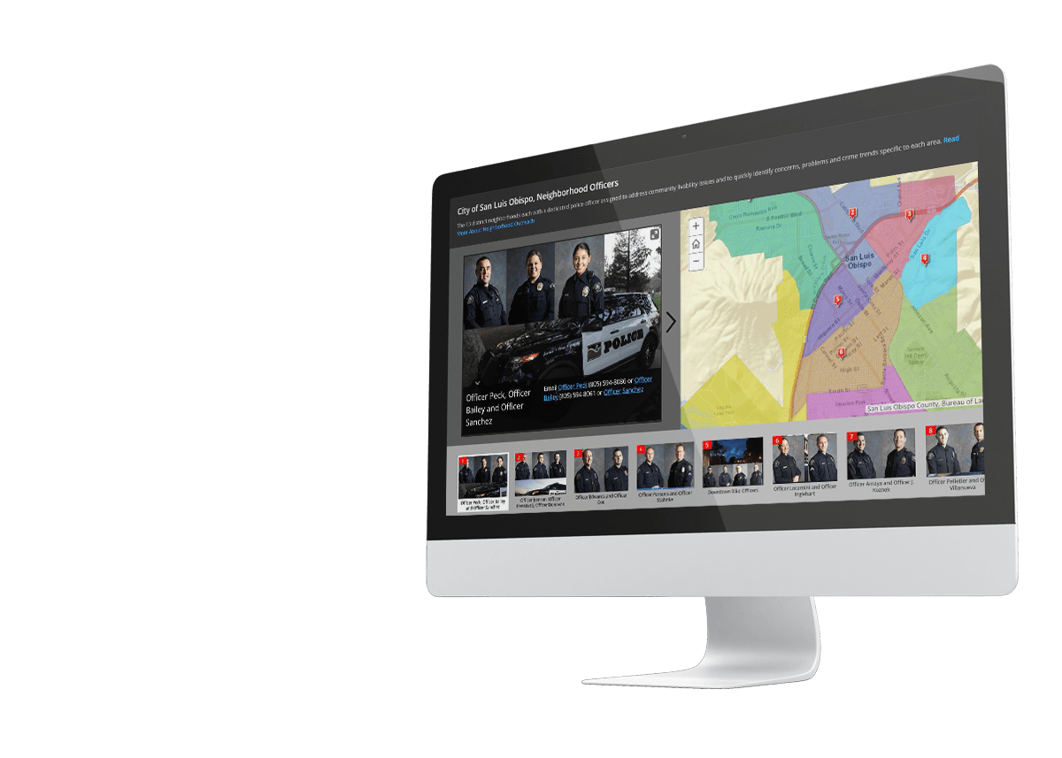
Public Safety GIS HUB
Information-Driven Initiative in Local Government
Geographic Technologies Group is planning, designing, and implementing Esri’s ArcGIS Hub solution for local government organizations and specific departmental and business applications. What will our GIS HUB do for you? It will offer your organization the following:
- A graphic-rich and easy way of organizing your data, information, and community characteristics into categories such as; Maps and Applications
- A tool to orchestrate and organize real-time specific data-centric initiatives
- Will help you introduce Open Data to your community so you can share data with the world
- A suite of Visualization Tools
- Real-time custom dashboards and insights into data
- Story maps and living documents
- Community engagement opportunities
- Work with internal and external stakeholders
- Tools and techniques for innovation
- It’s the next generation of crowdsourcing
The success of your ArcGIS Hub will be based on your imagination, desire, and the data you have to put into it. With all of this, the HUB can be an astronomical improvement to how you access and manage your GIS data and applications.
Call us to allow us to help you plan, design, and implement state of the art GIS!
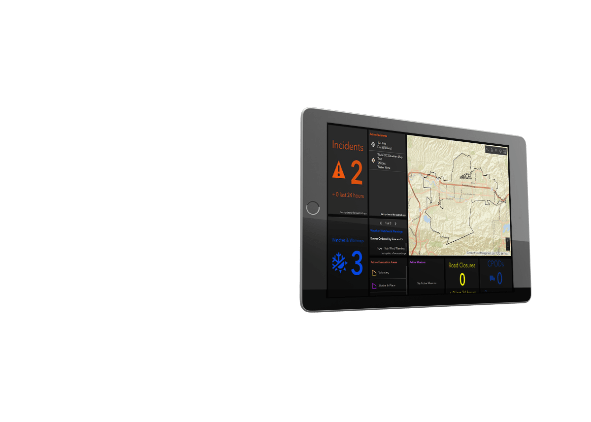
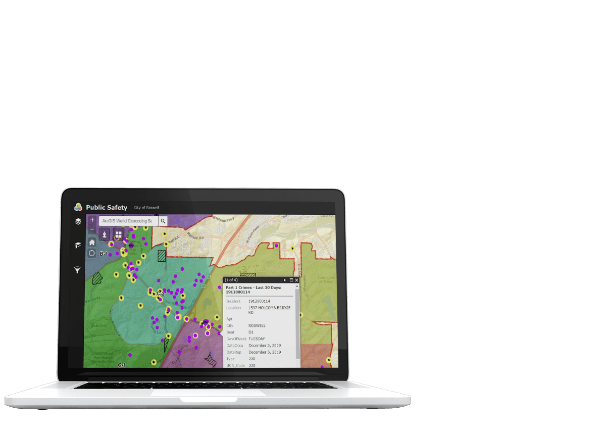
Safe City Center Common Operating Picture (COP)
Lightweight, incident mapping application that puts incident and GIS data in the hands of officers for a ‘quick view’ of what is happening in real-time. Streamlined and easy to use on any device, including desktop, laptop, tablets, and smartphones.

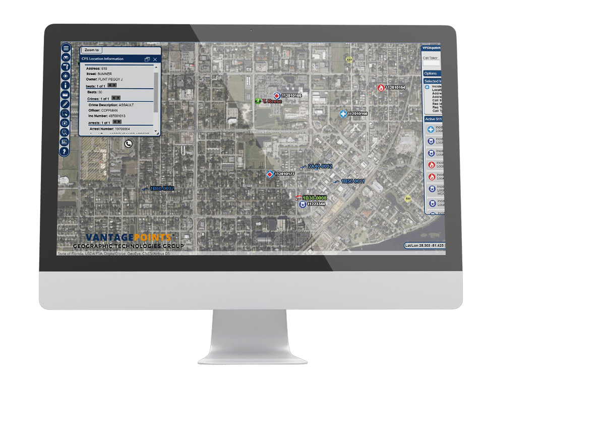
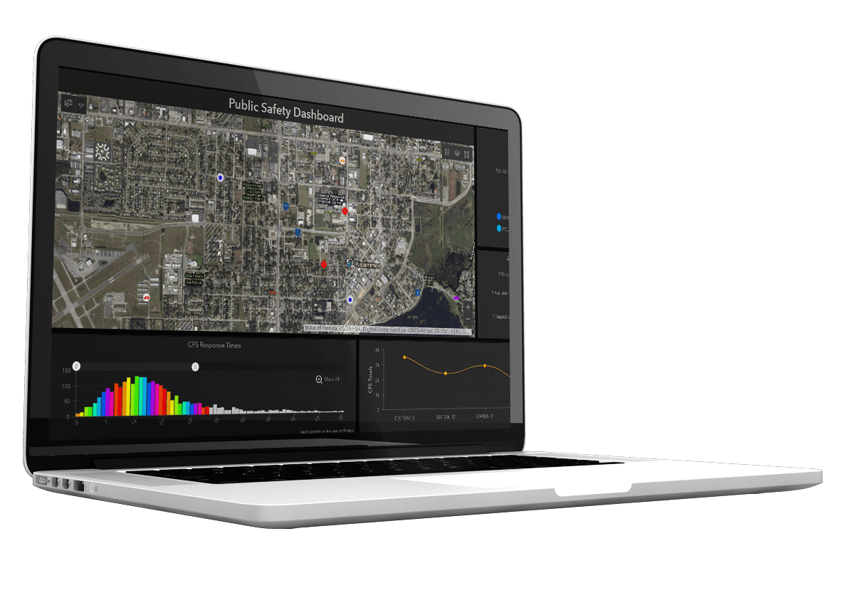
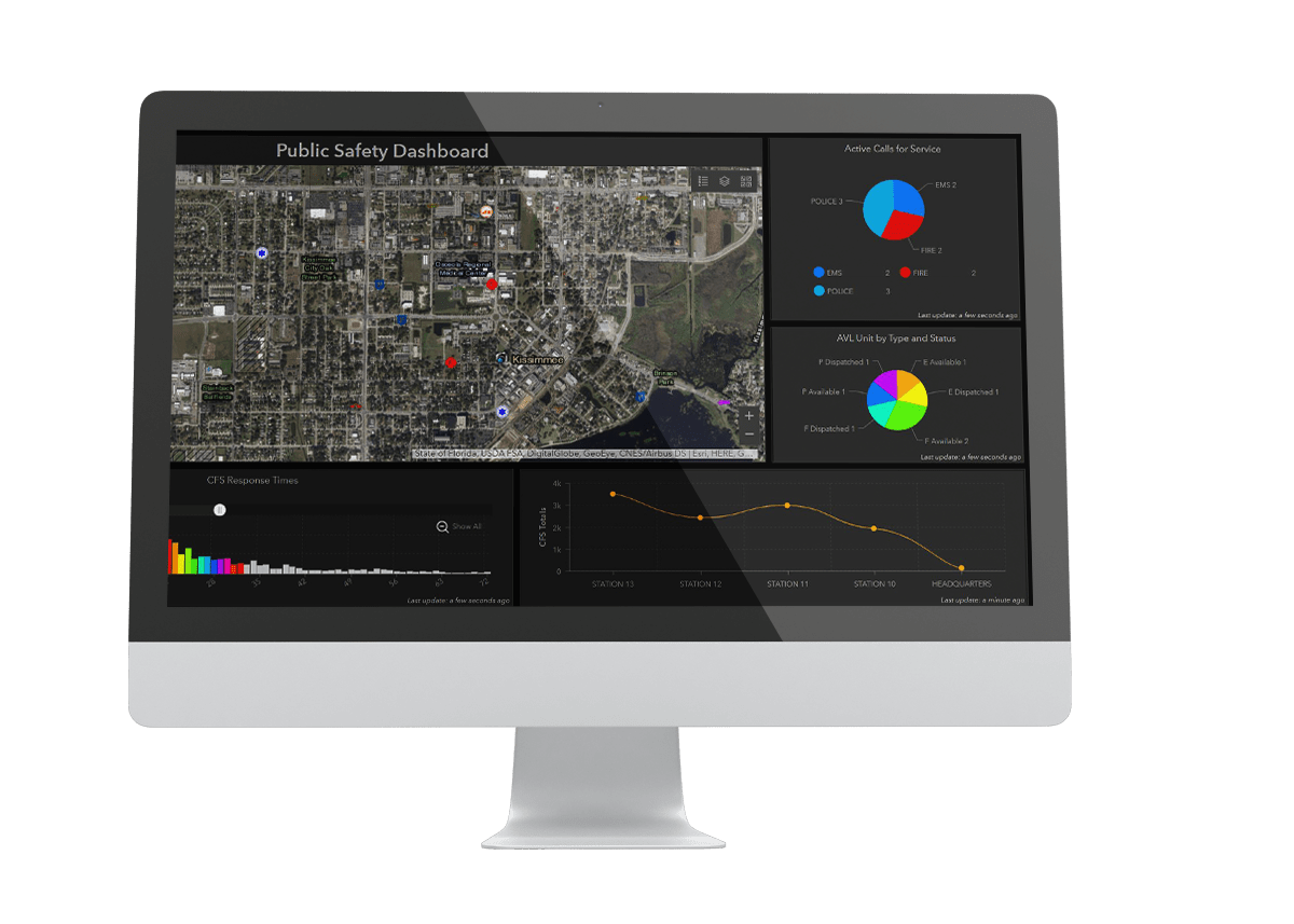
SafeCity Dispatch
SafeCity Dispatch is a Computer Aided Dispatch (CAD) mapping interface that provides E-911 dispatchers with an interactive map displaying the location of all emergency calls. SafeCity Dispatch uses the latest and most innovative technology to connect to your CAD data and provides a simplified setup and administrative interface. Mission critical data such as CFS, Phase I and II Calls, AVL, GIS Data, Hotlinks, Historical Database Integration, are all available in an easy to use interface.
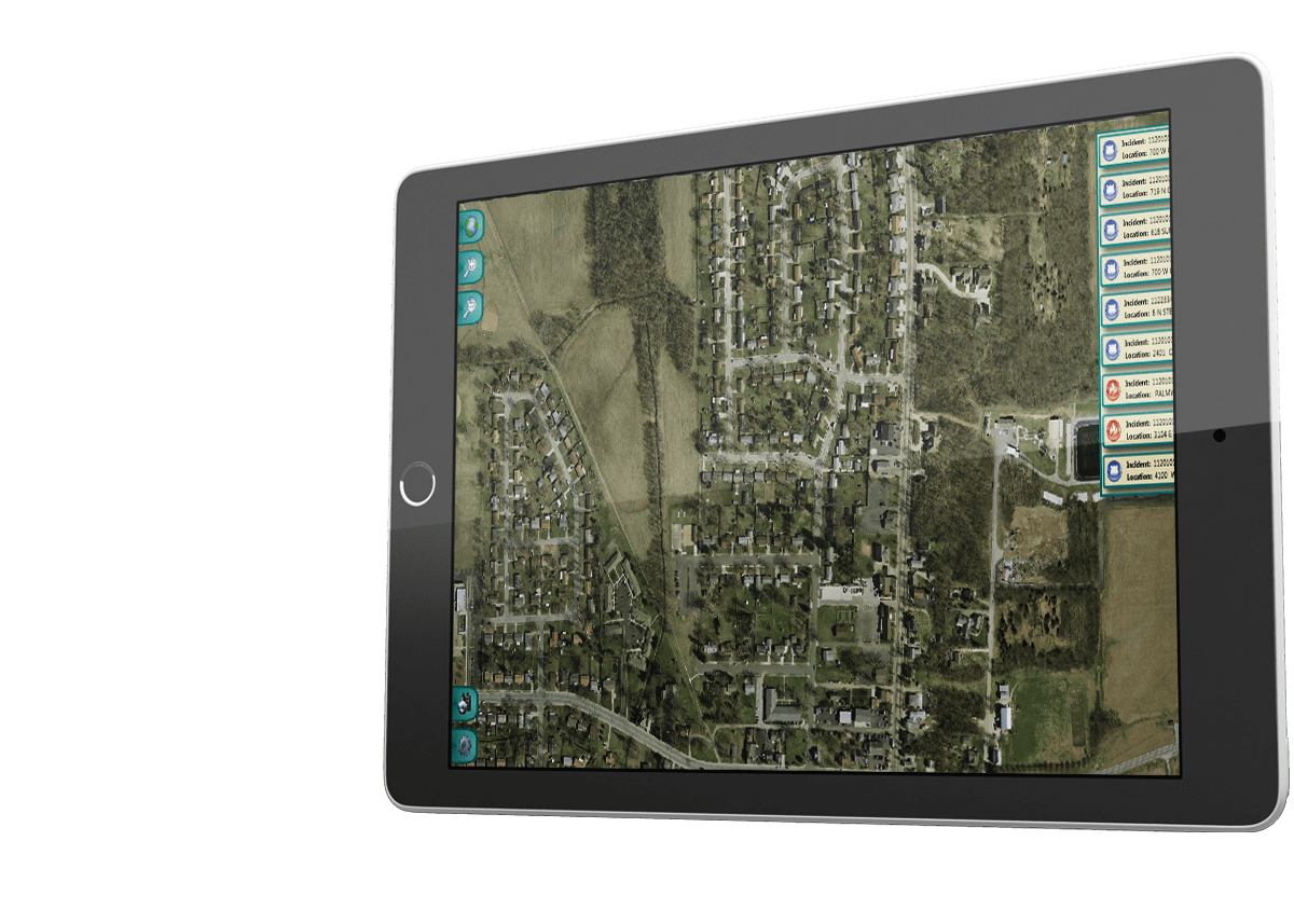
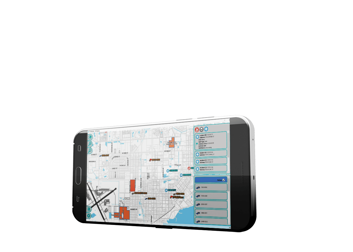
SafeCity Mobile
SafeCity Mobile is the latest breakthrough in mobile software solutions that allow users to access important GIS and 911-dispatch information. Active incidents, Automated Vehicle Location (AVL) units, and specific user events are all within the Mobile interface. SafeCity Mobile was designed to have an easy-to-use user interface that can be driven via a touch screen or a mouse.


SafeCity Automated Vehicle Location (AVL)
SafeCity AVL: Real-Time Tracking of GPS-Enabled Vehicles and Devices. SafeCity AVL provides the ability to group unit types and capabilities with unique icons such as Police, Fire, EMS, Sheriff, K-9, Marine Unit, Special Patrol, Detectives, Command Staff, etc. Historical playback feature is also available by unit, date, and time.
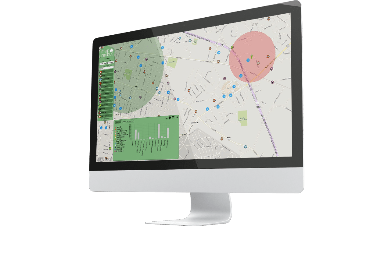
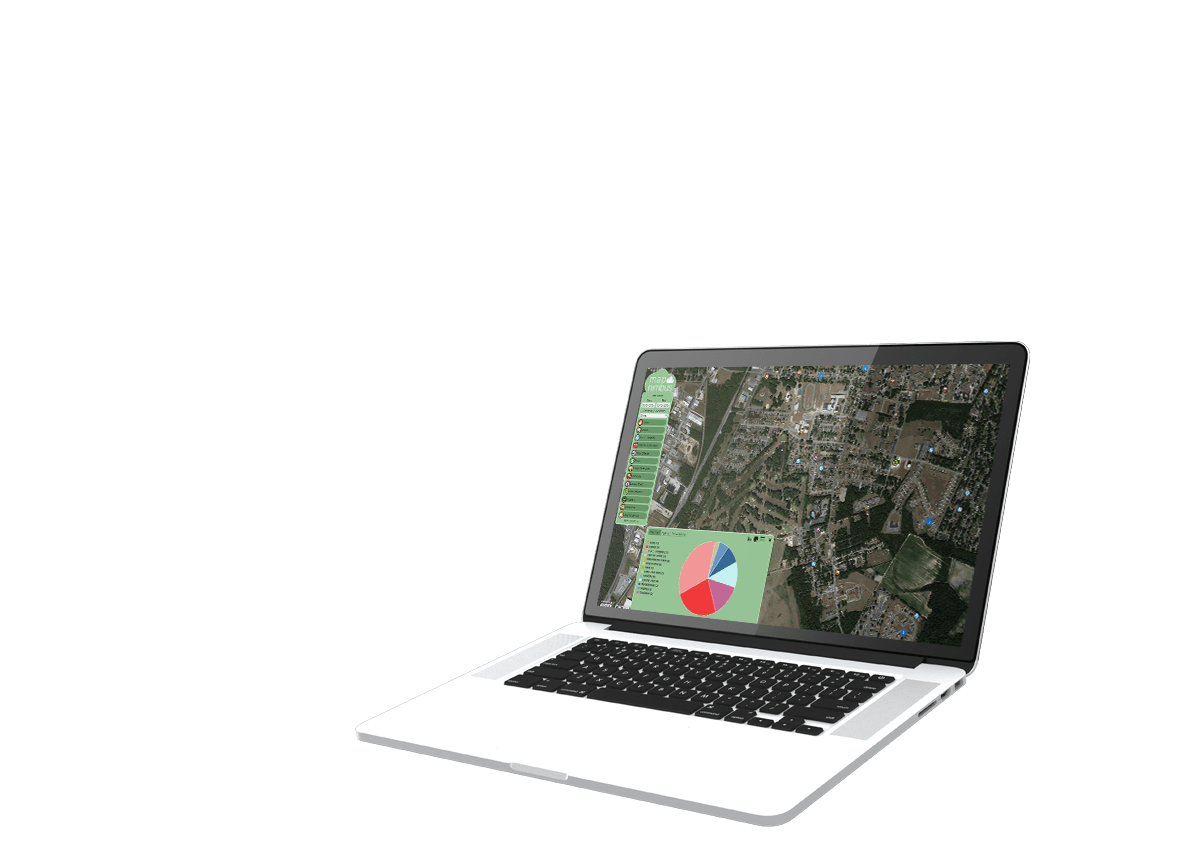
SafeCity MapNimbus
This dynamic web portal’s easy-to-use interface allows residents instant access to important, relevant, and comprehensive local government information such as Crime, Accidents, Warrants, Arrests, and Citations creating a more engaged and informed community. SafeCity MapNimbus provides residents the ability to sign up for automatic email notifications to be notified when an incident occurs within their home, work, school, or any predefined location.

Story Maps
Introduce first responders, highlight stations and facilities, promote upcoming events, share safety, health, and preparedness tips, provide information on disasters, share stories of community involvement, ask for the public’s assistance in solving crime or addressing a problem.

SafeCity GeoAdaptor
GeoAdaptor has the ability to automatically geocode and output GIS data layers from any non-spatial database.

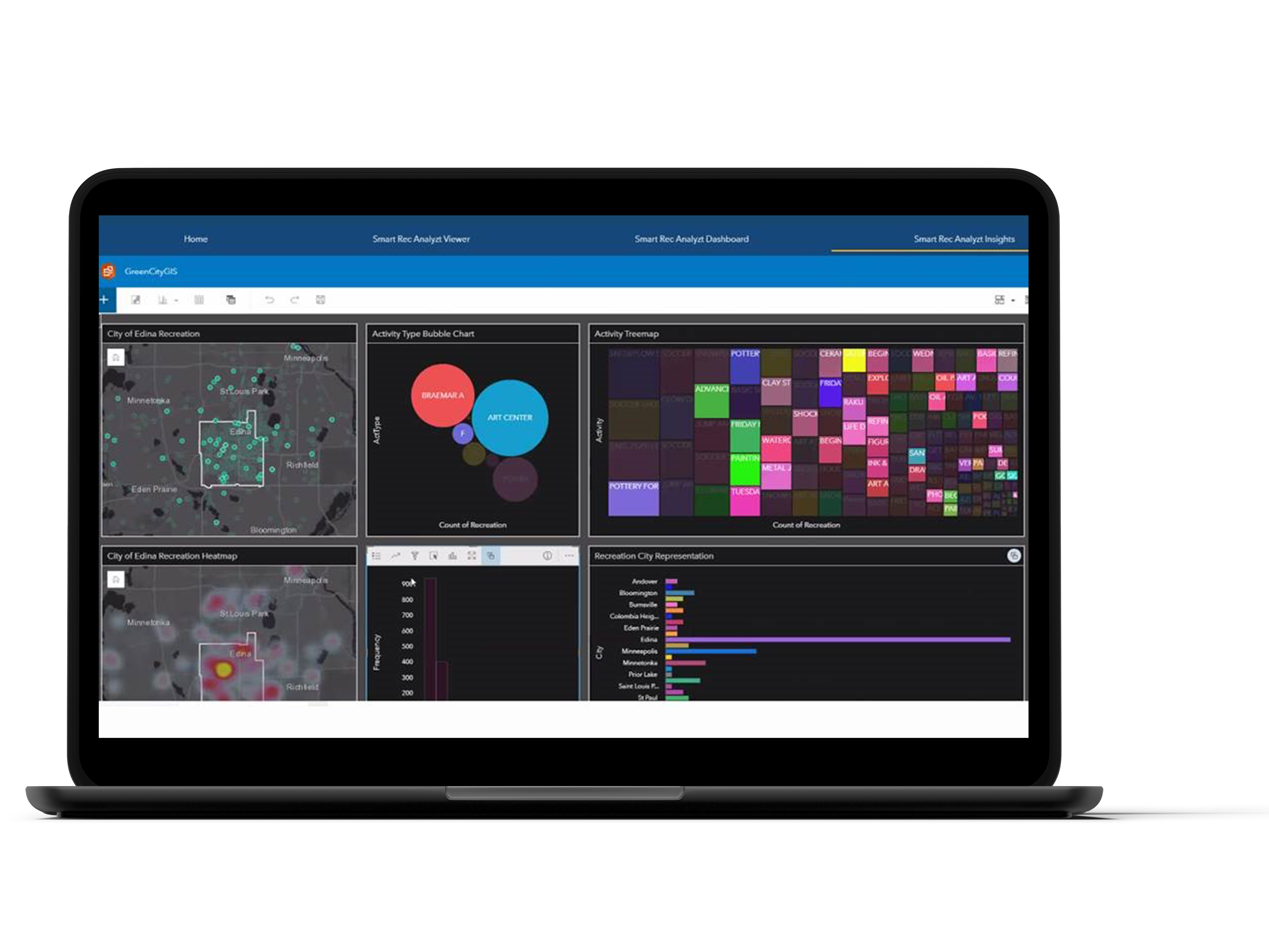
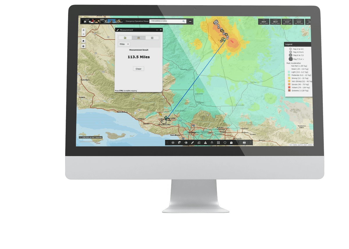
Esri’s ArcGIS Insights
Completely analyze your databases and unlocks new information
Our team uses Esri’s Insights tool to build solutions that analyze your data and databases. We focus on data and geographic location. We use Insights to deploy intuitive, easy to use, graphic-rich analytics that brings disparate data sets together. Insights can connect to many relational databases, spreadsheets, or Esri’s ArcGIS software. Our team will:
- Completely analyze your databases
- Unlock new information from your existing data
- Introduce new decision support technology
Esri’s ArcGIS Insights offers:
- Powerful analysis made simple
- Advanced statistical analysis such as heat maps, bar charts, and line graphics
- Advanced predictive analysis
- New insights about data using geography
- Intuitive geographic selection process – analyze data in a specific geography
Our team can deploy Esri’s Insights to gain a new perspective on data.
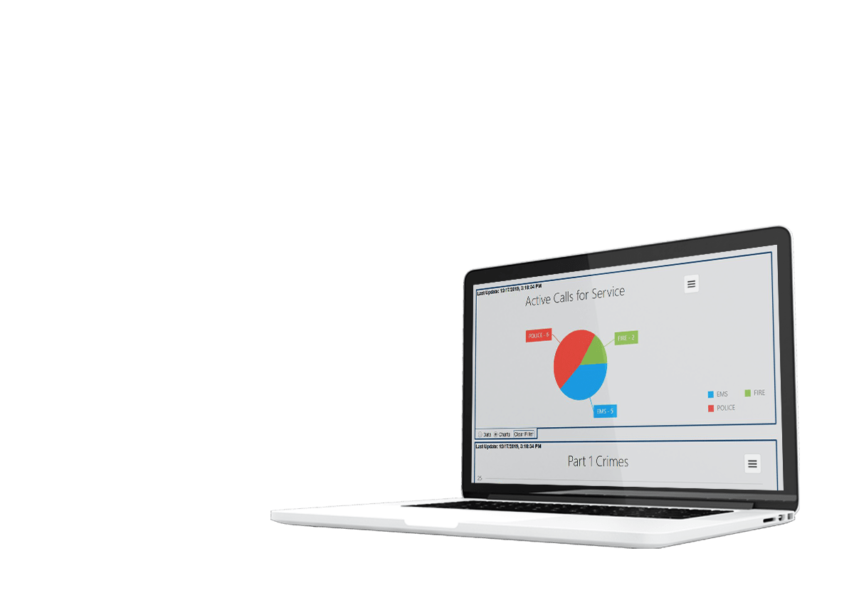
SafeCity Crime Analysis
SafeCity Crime Analysis is an easy-to-use crime reporting, mapping, and analysis software application designed for towns, cities, and counties of all sizes and complexities. SafeCity Incident Analysis aids in the visualization and analysis of law enforcement and fire incident information and enables automated mapping of incident addresses and call information, as well as dynamic query and browse capabilities that make crime and fire reporting and hot spot analysis easy. Identifying the spatial distribution of crime and fire records will allow for the maximized use of departmental assets and will satisfy the ever-growing demand for critical services. Police, Sheriff, and Fire departments can leverage and integrate available GIS datasets into their report datasets and perform spatial analysis, reporting, and visualization of current data by attribute.