

PLAN
Public Safety GIS Plan
95% of agencies underutilize mapping/GIS. A Public Safety GIS Plan is critical to ensuring that your department is optimizing its use of mapping/GIS. Every public safety organization is faced with hundreds of possible data and mapping possibilities. A Public Safety GIS Plan ensures that everyone in your agency has the optimal mapping/GIS tools and that all of your data is being mapped immediately and accurately. The power of GIS is immense for your agency. A Public Safety GIS Plan will ensure your success. The end result will be a safer community, an informed department and public, and much better insight into trends and patterns.
Public Safety Data Assessment
Most organizations struggle with timely access to accurate data. Our team of public safety data experts will review your data (GIS/mapping, records, dispatch, and others) to determine data gaps and procedural issues. The goal is to have 100% of your data mappable and available to all staff for decision making.
NG911 Data Assessment
Geographic Technologies Group (GTG) has over twenty years of experience helping public safety departments transition to the latest technology in communication systems, reporting, and data management. We have assisted over 250 Public Safety Answering Points (PSAPs) in implementing GIS software and data for their agency. We analyze your data for NG911 compliance and leave you with a detailed action plan for remediation or assist you in data clean up.
DATA MANAGEMENT
Public Safety Data
Our team will assist you in assessing and creating your critical data layers. We have analyzed the data sets of over 500 agencies in North America. We assist agencies in the creation and/or improvement of over 100 possible public safety data layers. This includes GIS data (i.e. zones, addresses, centerlines, etc.) and geo-enabling your existing data (records, calls for service, pre-plans, hazardous materials, etc.). We focus on optimization and automation of data sets so that your staff always have the data they need.

NG911 Data Creation
GTG will work with your team to create, convert, and collect all the data you need to run a complete GIS for your Next Generation Program. We utilize a 10-step process to analyze your data and ensure that it is NG911 compliant. We have helped over 250 agencies with critical GIS data for public safety.
SafeCity GeoAdaptor
A majority of agencies spend an inordinate amount of time trying to map data for use in the various mapping systems. Organizations resort to manual geo-coding efforts or a variety of home-grown scripts. GeoAdaptor automates all of these tasks. GeoAdaptor automatically geocodes and creates GIS data layers from any non-spatial database (records, dispatch, etc.). The application works in the background to geocode (by address or parcel number) your data sets.

DEPLOYMENT
Police / Sheriff / Dispatch
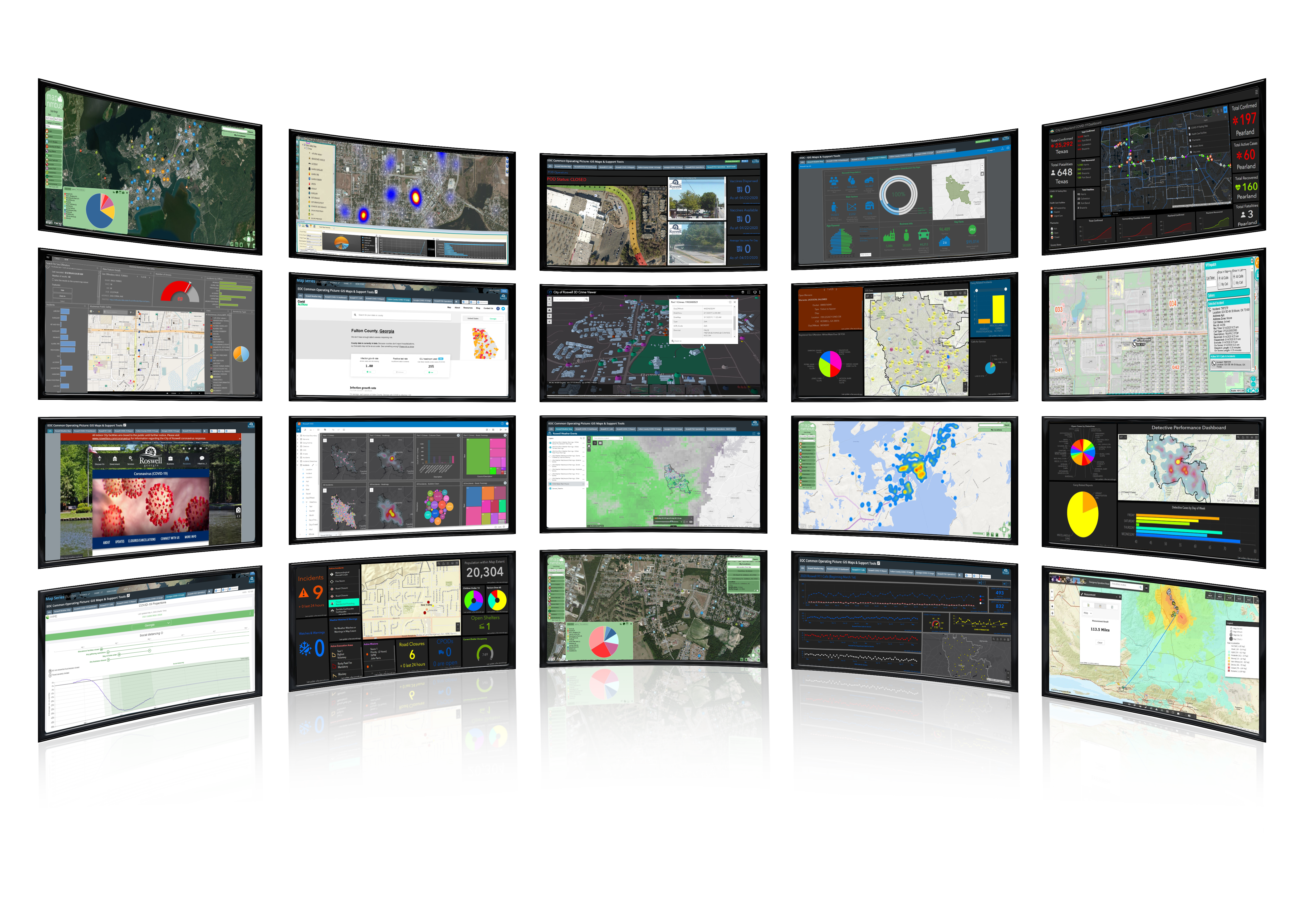
- Organizing your Agency with the Public Safety GIS Hub
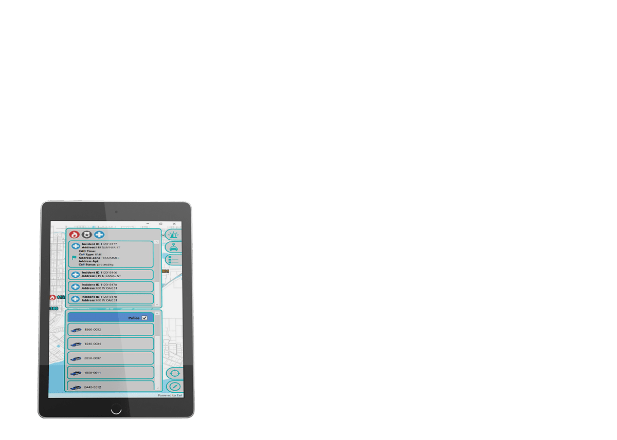
- Enabling Your Staff (Common Operating Picture (COP))
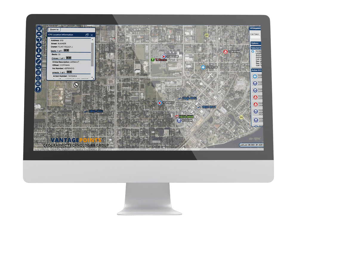
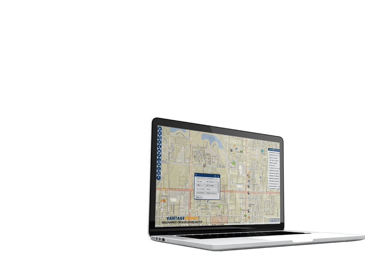
- Locating Calls
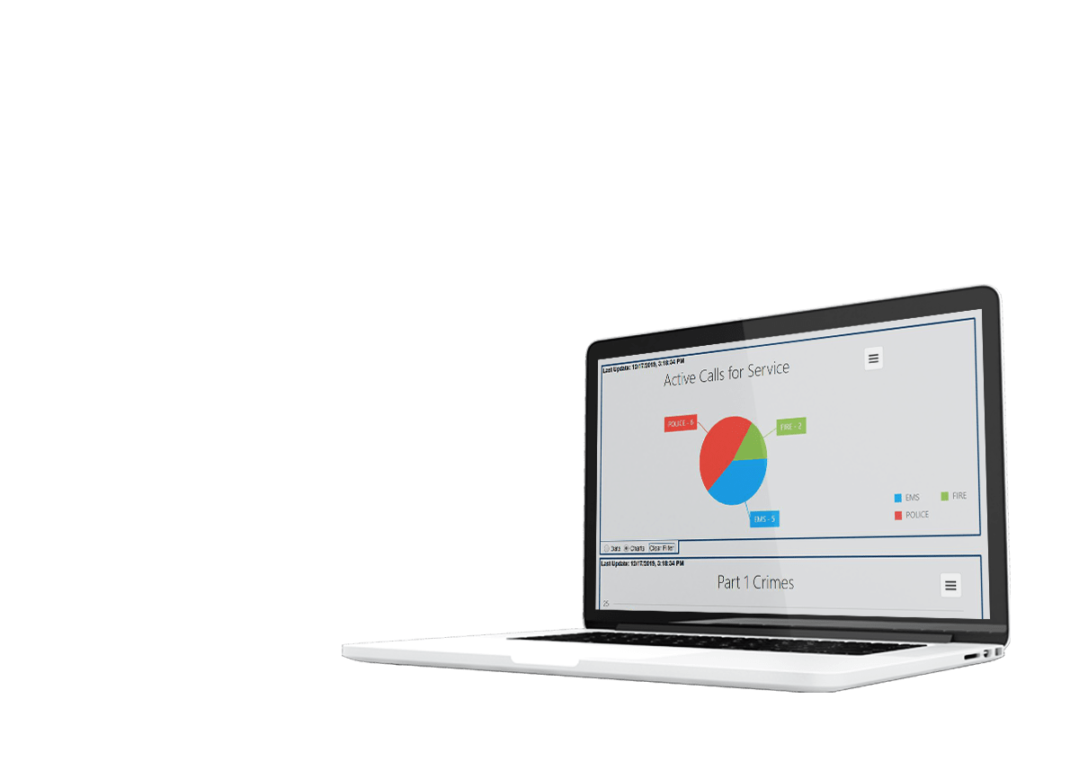
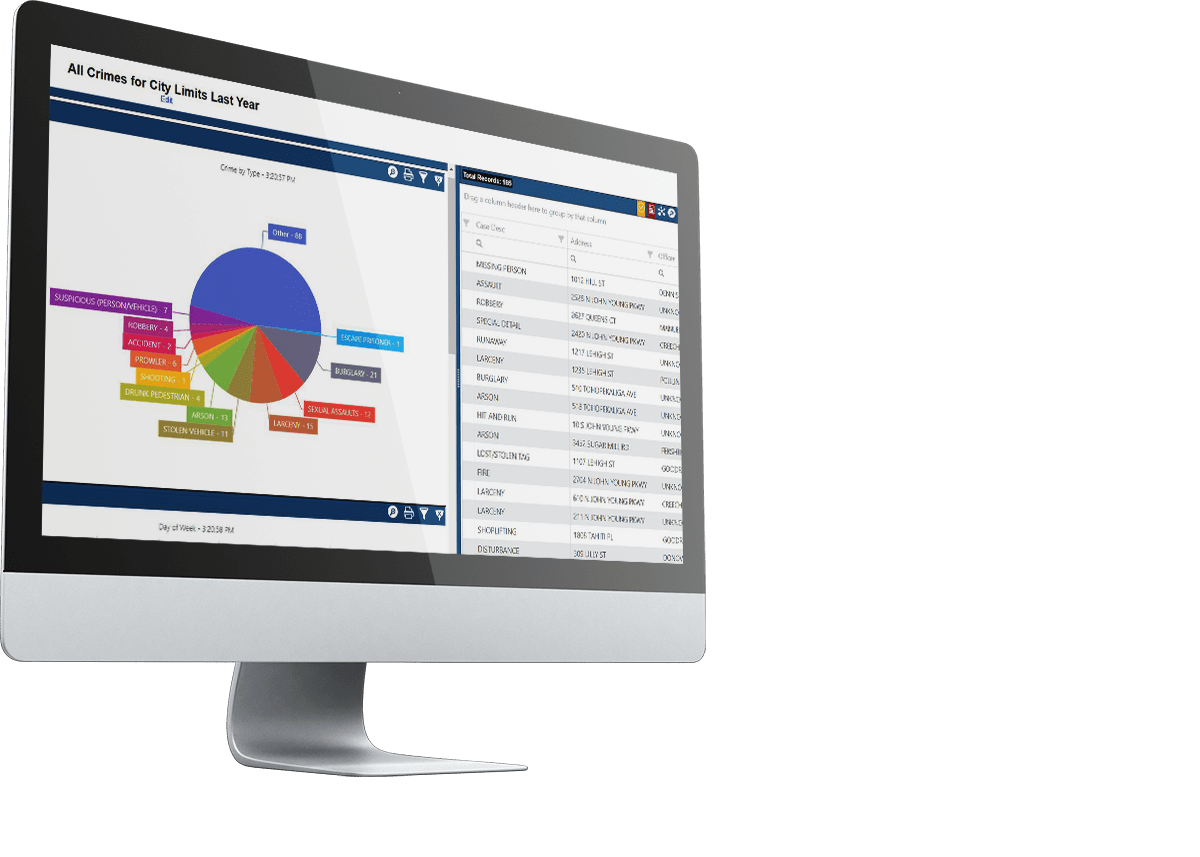
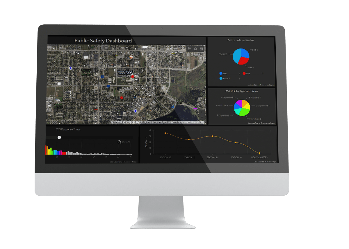
- Executive Insight – this will include Dashboards and Insights
- Telling Your Story (MapNimbus AND Story Maps)
- Mapping Your Data (GeoAdaptor)
- Crime Analysis
- View Building Pre-Plans in 3D
- Utilize GeoDetails


Fire/ EMS
- Organize your Agency with a Fire GIS Hub
- Enable Your Staff with a Common Operating Picture (COP)
- Gain Executive Insight with Dashboards and Esri’s Insights
- Tell Your Story with Story Maps
- Map Your Data with GeoAdaptor
- View Building Pre-Plans in 3D
- Utilize GeoDetails
EOC
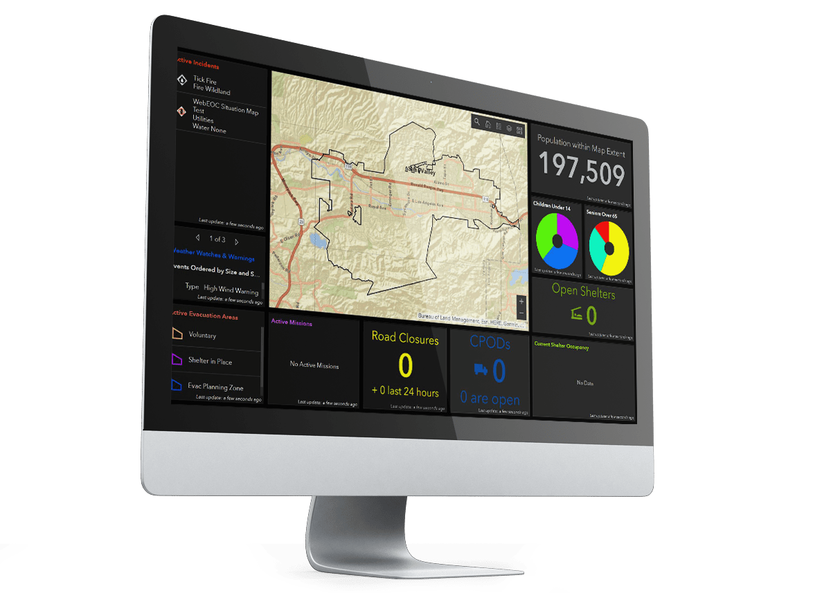
- Organize your Agency with an EOC GIS Hub
- Create an EOC Common Operating Picture (COP)
- Gain Call Location Views
- Executive Insight with Dashboards and Insights from Esri
- Collect Data with the Collector App
- Tell Your Story with Story Maps
- Map Your Data with GeoAdaptor

SafeCityGIS is the premier software and services solution for mapping, analyzing, and visualizing data to support data-driven decision making and operational efficiencies. GTG works with Towns, Cities, and Counties across the United States (and around the World) to create enterprise-wide GIS that is both innovative and sustainable.
To assess your organization’s specific needs, GTG offers a complimentary 30-minute consultation with our Public Safety experts. There are no strings attached. Schedule your call with our team and let’s work together to create safer communities.